Drones serve as game-changing tools in environmental research, enabling scientists to gather detailed data while minimizing ecosystem disruption. These aerial devices map landscapes, track wildlife movements, and assess vegetation health using advanced imaging technology. Equipped with sensors and AI capabilities, drones access remote locations and dangerous terraine that would otherwise be difficult to study. The integration of drone swarms and IoT networks creates unprecedented opportunities to monitor and protect Earth’s diverse habitats. The expanding possibilities of drone research continue to transform our understanding of the natural world.
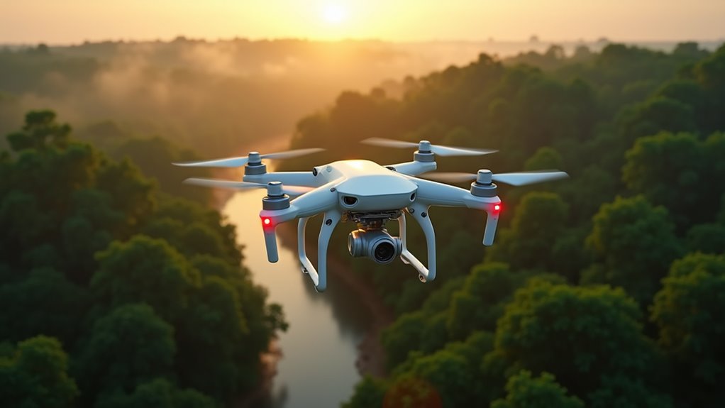
While environmental researchers have long relied on traditional methods like ground surveys and satellite imagery, the emergence of drone technology has revolutionized how scientists monitor and protect our planet’s ecosystems. These unmanned aerial vehicles equipped with sophisticated sensors and cameras now enable researchers to collect high-resolution data more efficiently and cost-effectively than ever before, while minimizing disruption to sensitive habitats and wildlife populations.
The versatility of drones in environmental research is remarkable. Scientists deploy them for aerial mapping of vast landscapes, tracking wildlife movements, and evaluating vegetation health through multispectral imaging. These flying platforms carry various specialized sensors, from thermal cameras that detect animals in dense forests to gas sensors that measure air quality and pollutant levels. LiDAR technology mounted on drones creates detailed 3D maps of terrain, while water quality sensors help researchers study aquatic ecosystems without disturbing marine life. Remote pilot certified professionals ensure safe and compliant operation of these sophisticated aerial systems. Rising global temperatures have increased the urgency of using such technologies to monitor and mitigate climate change impacts on biodiversity. Machine learning models are being employed to predict trends in ecosystem health and help optimize sustainability measures.
Modern drones equipped with advanced sensors revolutionize environmental monitoring, from wildlife tracking to creating detailed 3D terrain maps.
One of the most significant advantages of drone technology is its ability to access remote or dangerous areas that would be challenging or impossible for human researchers to reach. Drones can fly into active volcano zones, navigate through dense rainforest canopies, and hover over treacherous wetlands to collect valuable environmental data. The real-time transmission capabilities allow scientists to make immediate decisions based on the information gathered, particularly essential during natural disasters or environmental emergencies. Using thermal imaging technology, drones can effectively locate wildfire hotspots for improved disaster response.
Drones, AI, and tracking tools have transformed wildlife conservation efforts by enhancing the ability to monitor endangered species and gather critical habitat data.
However, environmental drone research faces several challenges. Battery limitations restrict flight times, and weather conditions can ground operations. Regulatory frameworks often impose strict guidelines on drone operations, particularly in populated areas or protected wildlife zones. The massive amounts of data collected require sophisticated processing and analysis systems, while privacy concerns must be carefully balanced against research objectives. Furthermore, the integration of clean technology into drone systems has become essential for reshaping energy consumption and reducing the environmental footprint of these operations.
The future of environmental drone research looks promising with emerging technologies. Swarm technology enables multiple drones to work together, covering larger areas more efficiently. Artificial intelligence and machine learning algorithms are being developed to automate data analysis, while hydrogen fuel cells offer the potential for longer flight times. The integration of drones with Internet of Things (IoT) devices is creating extensive environmental monitoring networks that provide unprecedented insights into ecosystem health.
Ethical considerations remain at the forefront of drone-based environmental research. Scientists must carefully weigh the benefits of their studies against potential negative impacts on wildlife and local communities. Standardized guidelines are being developed to guarantee responsible drone usage, including protocols for minimizing wildlife disturbance and protecting data privacy.
As this technology continues to evolve, its role in understanding and preserving our natural environment becomes increasingly important, offering new possibilities for conservation efforts and environmental protection strategies.
Frequently Asked Questions
What Licenses Are Required to Operate Drones for Environmental Research?
Environmental drone research requires several key licenses.
The FAA Part 107 Remote Pilot Certificate is mandatory for commercial operations, including research. Some states demand additional permits – like North Carolina’s state certification.
Special authorizations are needed for controlled airspace, night flights, or operations beyond visual line of sight.
Environmental agencies and universities often require internal approvals, and specific permits apply for protected areas like national parks.
How Long Can Research Drones Typically Stay Airborne on One Battery Charge?
Research drones typically achieve flight times between 25-60 minutes per battery charge, depending on their classification and payload.
Professional models equipped with 10,000+ mAh batteries can stay airborne for up to 60 minutes, while mid-range drones using 5,000-7,000 mAh batteries average 25-35 minutes.
Weather conditions, payload weight, and flight patterns greatly affect duration.
Some specialized research drones using hydrogen fuel cells can achieve up to triple these flight times.
Can Drones Operate Effectively in Extreme Weather Conditions During Research Missions?
Modern research drones can operate in challenging weather through advanced adaptations.
With sealed housings, high-pitch propellers, and heating elements, they withstand rain, cold, and winds up to 25 m/s.
Environmental sensors and AI systems automatically adjust flight parameters based on conditions.
While extreme weather still poses limitations, technological solutions like de-icing systems and adaptive controls enable successful missions in harsh environments for glacier surveys, wildfire monitoring, and atmospheric research.
What Happens if a Research Drone Malfunctions Over Protected Wildlife Areas?
When a research drone malfunctions over protected wildlife areas, several immediate risks emerge. The drone’s emergency protocols typically initiate a controlled descent, but system failures can lead to crash landings.
Wildlife may experience temporary disturbance or stress, while sensitive habitats could sustain damage. Modern drones feature fail-safe systems and biodegradable components to minimize impact.
Operators must follow strict protocols, including pre-flight checks and maintaining communication links, to prevent such incidents.
How Much Does a Professional Environmental Research Drone Typically Cost?
Professional environmental research drones typically cost between $2,000 and $50,000, depending on their capabilities and specifications.
Entry-level models like the DJI Mavic series start around $500-2,000, while mid-range options with advanced features range from $2,000-10,000.
High-end research drones equipped with specialized sensors and extended flight times can exceed $50,000.
Specialized environmental monitoring drones with custom configurations may cost upwards of $100,000.